Three April Storms Are About to Set Cold-Weather Records Across the Country
If you're wondering why the springtime weather is taking its sweet, sweet time to show up, you're definitely not alone. Winter is having itself a grand old time sticking around in many parts to the United States, like that awkward last party guest who just hasn’t gotten the hint they need to leave. In fact, three different storm systems are on track to not only potentially set cold-weather records, but also dump snow in many parts of the country where t-shirt season should already be in full swing. Could you hear that collective ughhhh?
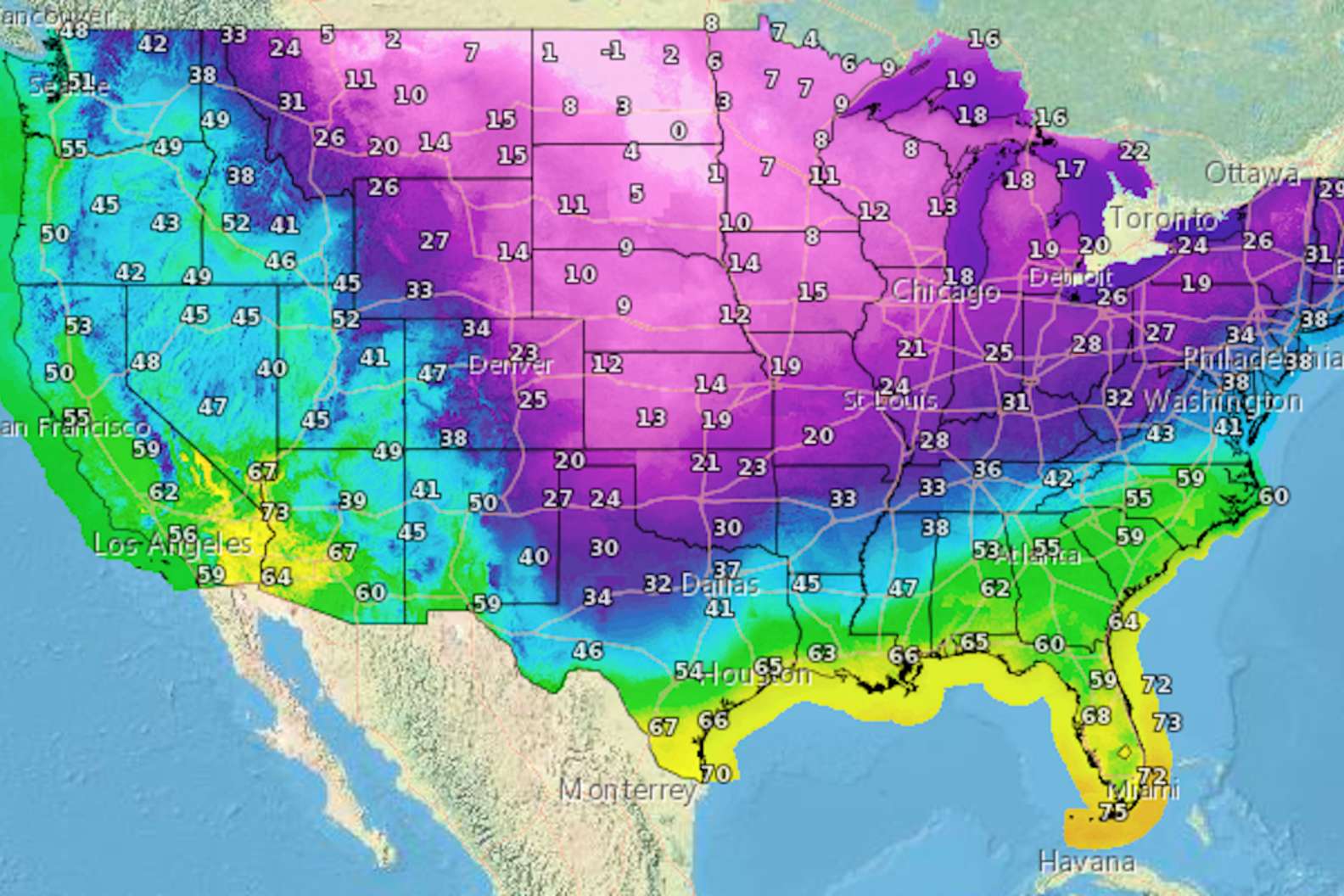
At the moment, parts of the Upper Midwest, Great Lakes, Ohio Valley, Mid-Atlantic, and New England are bracing for a trio of potential “snowmakers” that could lead to some very unwelcome accumulation of white stuff and even more unwelcome chilly temps.
So what gives!?! Here’s what you need to know.
Why is it still so cold this late in the year & when will it warm up?
Two words: polar vortex. An upper level low pressure system anchored up in Canada is currently pushing a wave or Arctic air downward in what is hopefully the death rattle of this year’s winter season. It, unfortunately, may stick around past this weekend, too. The polar vortex “lobe” that’s causing all the cold will likely retreat northward to Canada during the next week, according to a recent Accuweather report.
What’s the forecast?
Through Friday night, a snow or a mix of snow and rain is expected across large parts of the Ohio Valley including southern Illinois, Kentucky, southern Ohio, West Virginia, Pennsylvania, and western Maryland. Snow is also expected to continue throughout the Northeast and New England through Saturday.
Not much, if any, accumulation is expected in the Midwest, but the mid-Atlantic and Northeast could see up to four inches, though warmer ground temps and potentially heavy snowfall rates could mean much of it will melt as it comes down. By the end of the weekend, a third storm could spread a good deal of snow -- between six to 12 inches -- from the Rockies to the northern Plains, per Weather.com.
What sort of records are being broken?
On Wednesday, April 4, the air temperature in Aberdeen, South Dakota measured a record low of -6 degrees Fahrenheit, the coldest ever recorded during the month of April. Similarly, the National Weather Service is forecasting the coldest day on record for Minneapolis, with an expected high of just 21 degrees.
On Friday, high temperatures across the northern and central Plains were nearly 30 degrees below normal, and will continue to be well below normal through the weekend. There’s also a chance that it will snow in Washington, D.C. on Saturday, which would be quite something since the nation’s capital hasn’t recorded even an inch of snow during the month of April since 1924.
Sign up here for our daily Thrillist email and subscribe here for our YouTube channel to get your fix of the best in food/drink/fun.